Fire map UX research
Background

INFORMATION

The Fire Incident Map is the main tool used by residents of Northern California to keep track of active fires, evacuations, and general guidance of how to proceed during wildfires situations.

The map is made using the ArcGIS platform. The MapViewer of the ArcGIS system allows the creation, management, and analysis of spatial map data.

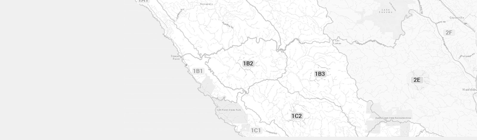
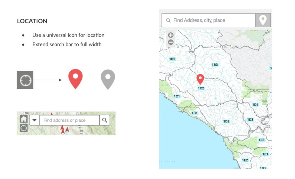
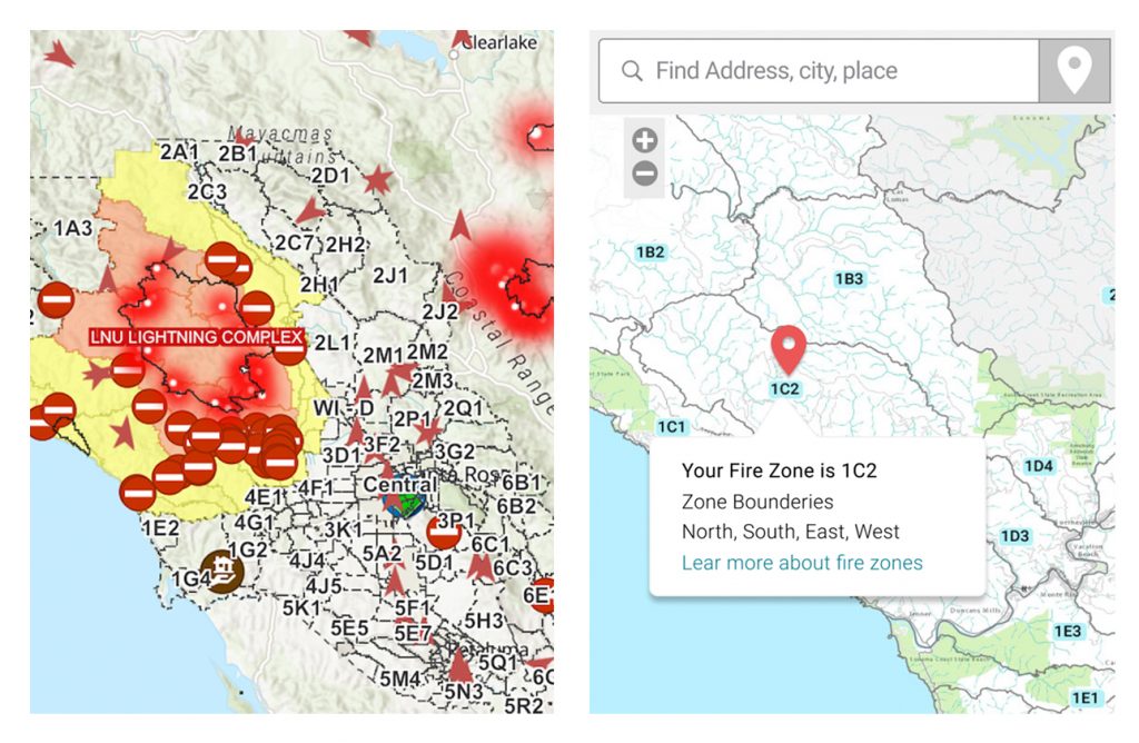
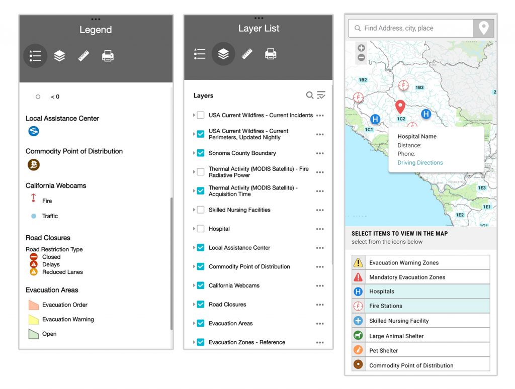
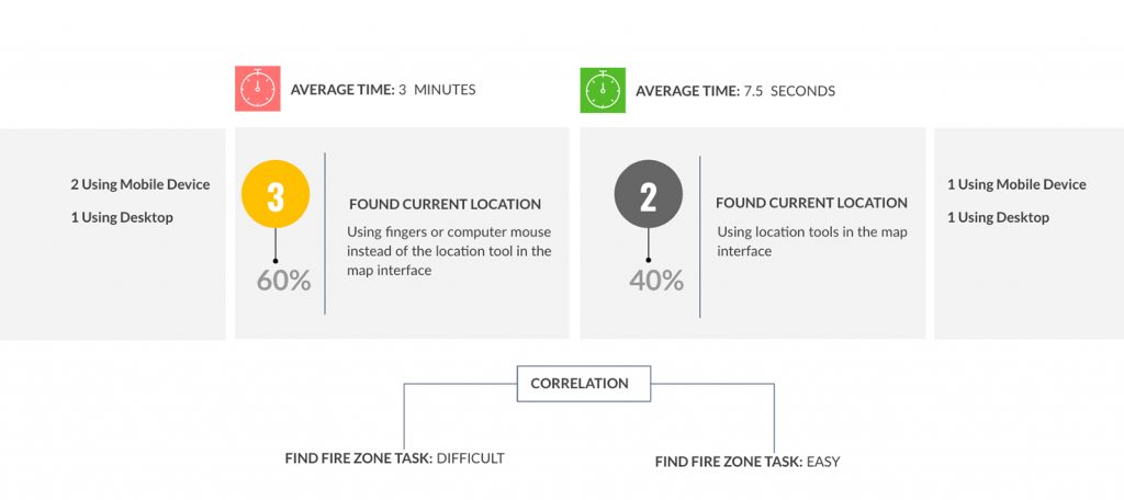
Over the last year the map had different revisions and changes to its interface. The latest map modification divides the counties into fire zones and added new elements into the interface. 

OBJECTIVE

The main objective of the map research was to understand how people view, interact, and use the current Fire Emergency Map and to identify any challenges users have with its interface and areas of improvement.

TARGET GROUP

General Target Group: People living in the North Bay Area: Sonoma, Napa, and Lake Counties.

Specific Target Group: Fire survivors , fire evacuees and their families.

RESEARCH TYPE

  • User survey
  • Survey number of participants: 55
  • Usability Testing
  • Usability Testing Participants 5

SURVEY TOP FINDINGS

84%

Of users visited the map 10 times or more in the past 2 years

The participants of the survey were residents of wildfire affected areas in the Northern California. They also have diverse skill sets and age limitations with technology; however they were all familiar with the map interface.

90%

Of users visited the map to follow the progress of fires

The map is an effective tool to visualize the warning evacuation areas and the mandatory evacuation areas using color coding. 

82%

Of users said they can located their home on the map 

When asked if they can locate their home in the map 82% of the participants said that they could find their home in the map.

Emergency Evacuation and Warning zones
Fire Emergency Map, mandatory & warning evacuation zones - Glass Fire incident 2020

PROBLEM AREAS

10%

Only 10% of users found the correct Fire Area Code for their homes

46%

Only 46% of users know how to use the map’s layers feature or the map’s legend feature

90%

Of users do not understand the meaning of the icons used in the map.

Suggested

IMPROVEMENTS

1. LOCATION

Location is one of the most important features for the users. The map should let the users know where they are located in the context of the map, how far or close they are from a possible danger situations in a fast manner. Users do not understand the current location icon.

  • Use a better known icon for location.
  • Extend search bar to full width.
Location solution map
Suggested improvements for location tools and UI

2. VISIBILITY

The introduction of the Fire Area Codes is recent, only 10% of the participants new their home’s code. The current load of the information on the map interface makes it difficult to read the Fire Area Codes. Including contrast labels with the area’s parameters information could help the users find their respective area.

Fire zone code solution
Suggested improvements for Fire Zone Codes with labels

3. INTEGRATION

Combining the layers and legend sections will reduce the amount of clicks that the users currently have to do in order to understand the symbols and icons on the map’s interface,

Presenting the icons with their legend will save time for the user and increase understanding.

Layers & Legend Integration

4. ICONS

The icons used in the map are misunderstood or have a meaning unknown by the users. Therefore, there is a considerable amount of information lost. Redesigning the icons and placing them next to their legend with its meaning could increase understanding.

new map icons
New Icons with legend & information
Other

INSIGHTS

TIME

Time is a precious commodity during emergencies and every second counts. During the usability testing, participants were ask to find their home location on the map. There was a significant time difference between the users who knew and used the location tools versus the users that navigated the map using the pinch touch screen action or their computer’s mouse to locate their home on the map.

user testing time
User testing find location time

Info