Every year residents of Northern California live through fire season. The phrase “Sonoma Strong” is no longer sufficient to endure or survive the unpredictability and danger of wildfires.
I designed a prototype for a Fire Emergency app to address fire preparedness, education, and tools that provide the necessary resources to take immediate action during an active wildfire situation.
THE USERS
The app was built to be user friendly; with an easy follow structure that minimizes the amount of learning needed by the user. The app is protected to be utilized mostly during emergencies; therefore, psychological factors like short attention span and stress were taken into consideration. Moreover, wildfires affect people of every age group who have different relationships with technology.
STORY BOARD
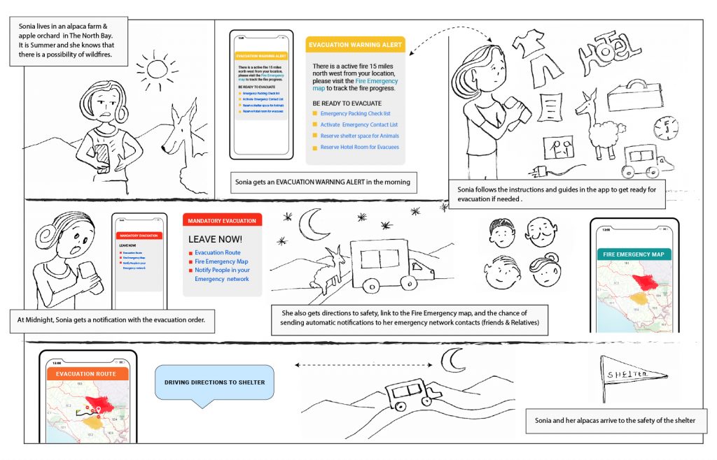
The story board reflects a typical situation by a rural resident of a wildfire affected area.
Fire Emergency App Storyboard
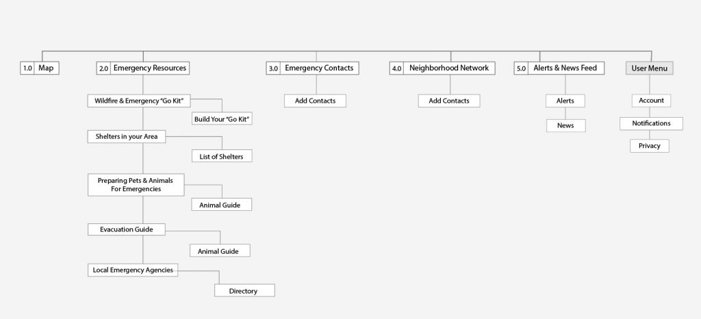
SITEMAP
The app is designed to present a set of tools and resources to help users during fire emergencies, with a linear user flow and information architecture designed for speed and simplification of tasks.
Fire Emergency App Sitemap
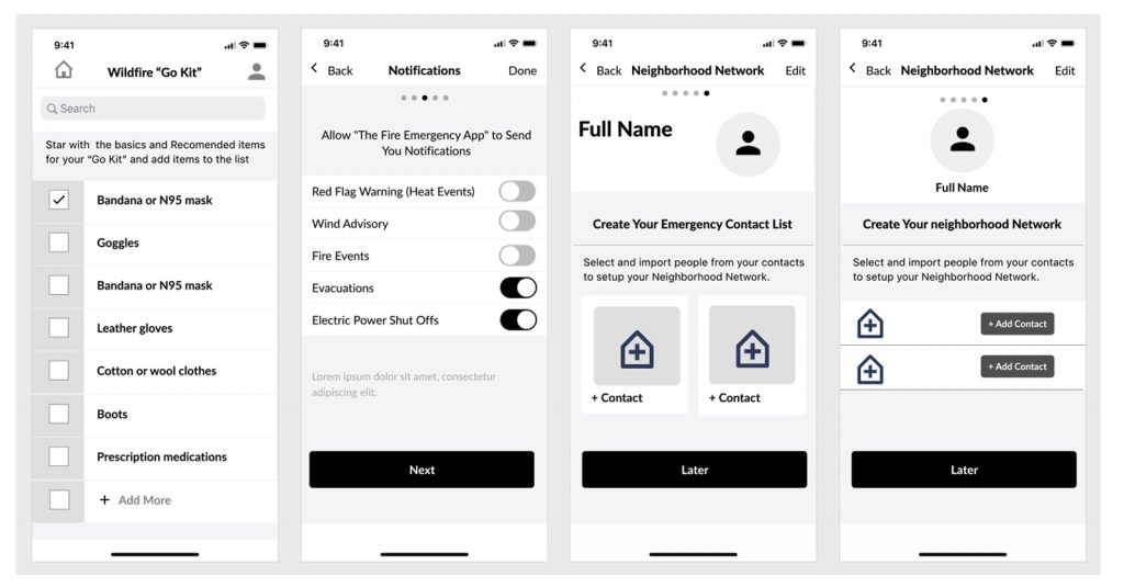
WIREFRAMES
Fire Emergency App Wireframes
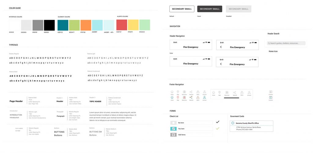
The app design guide was made using color coding to represent the type of emergency. Reserving yellow for warnings, red for mandatory evacuations and location marking, and green for areas free of emergencies. The typography used was clean and breathable for easier readability.
STYLE GUIDE
The app design guide was made using color coding to represent the type of emergency. Reserving yellow for warnings, red for mandatory evacuations and location marking, and green for areas free of emergencies. The typography used was clean and breathable for easier readability.
Fire Emergency App Style Guide
CONTENT
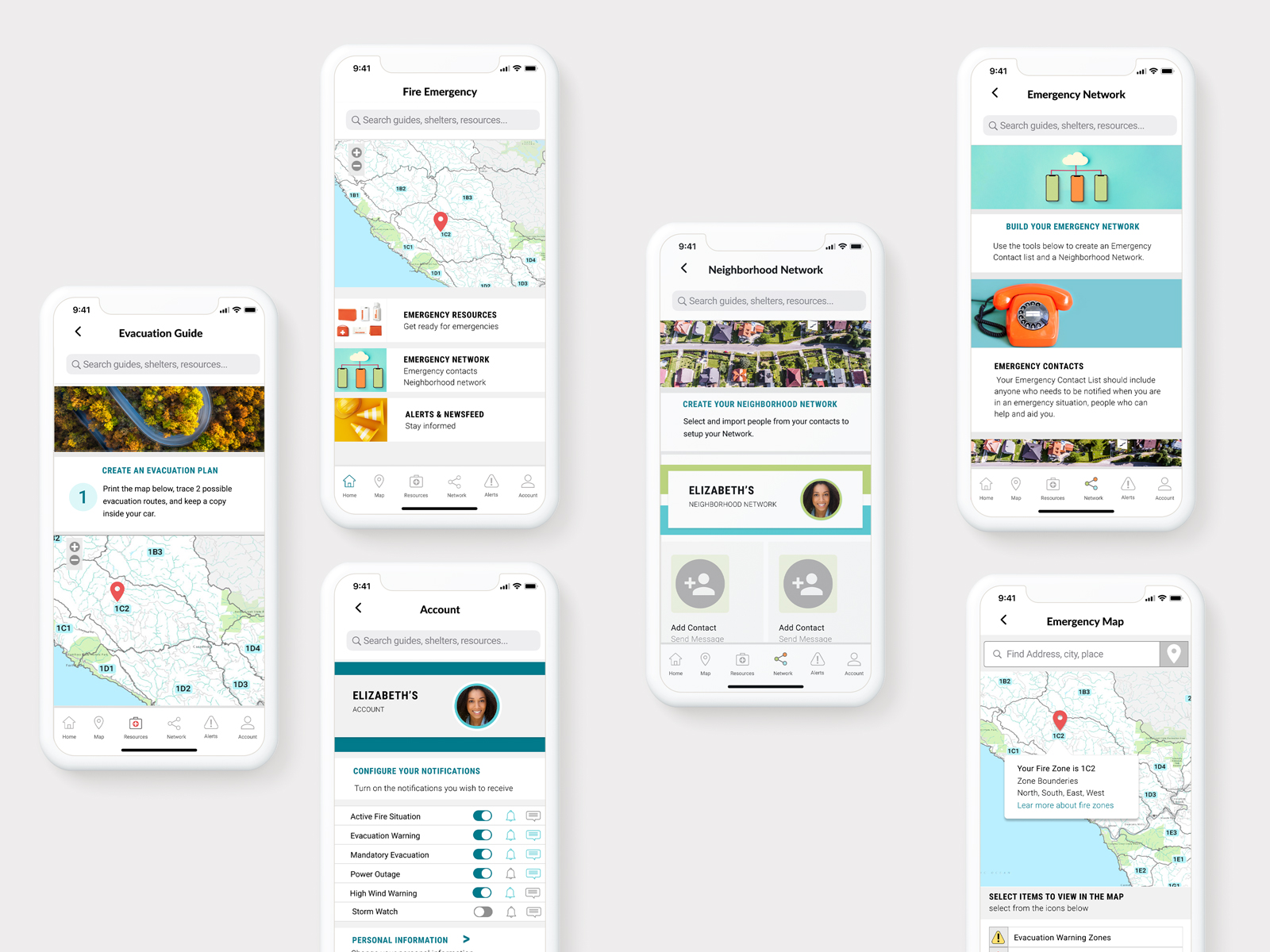
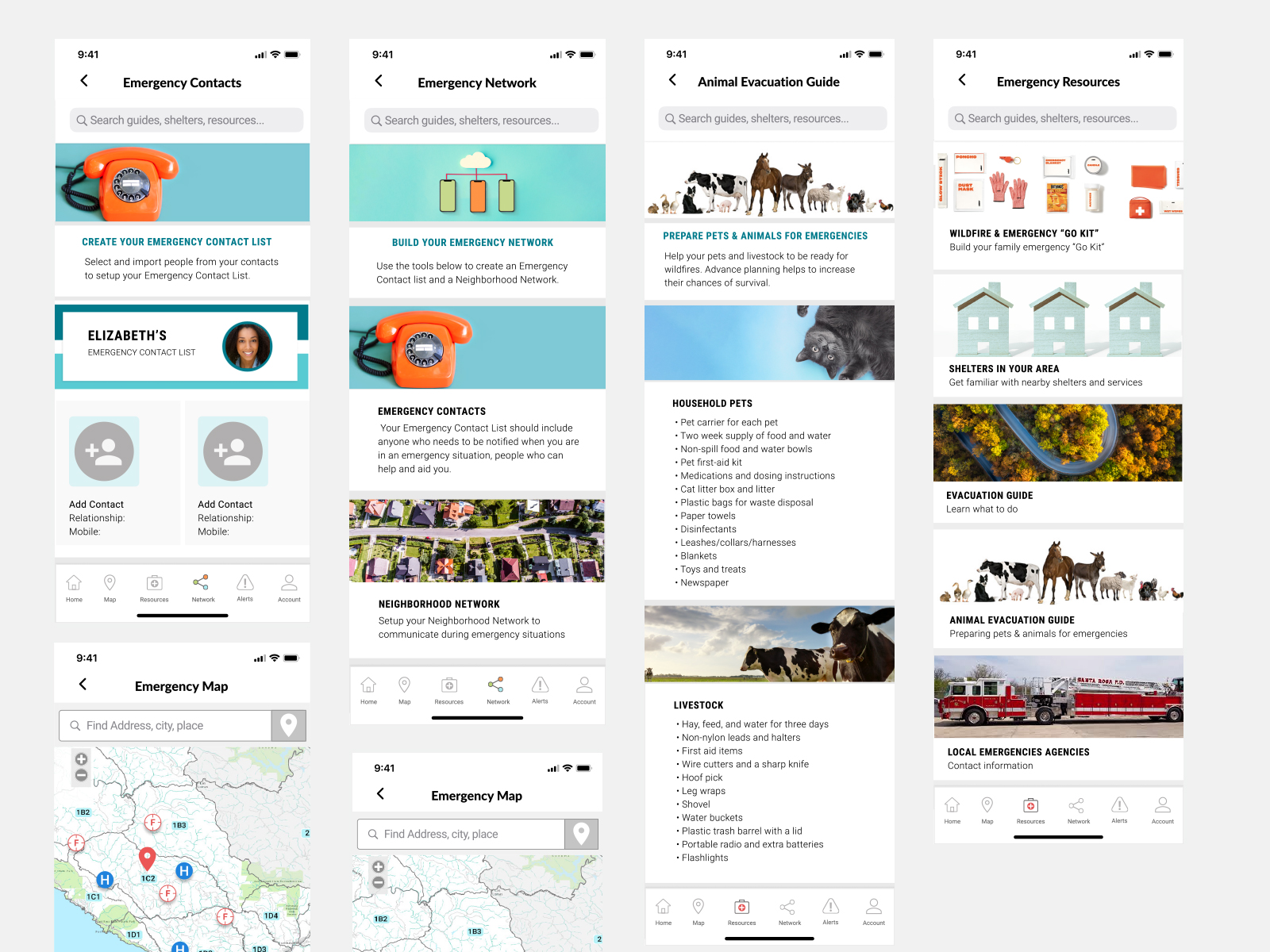
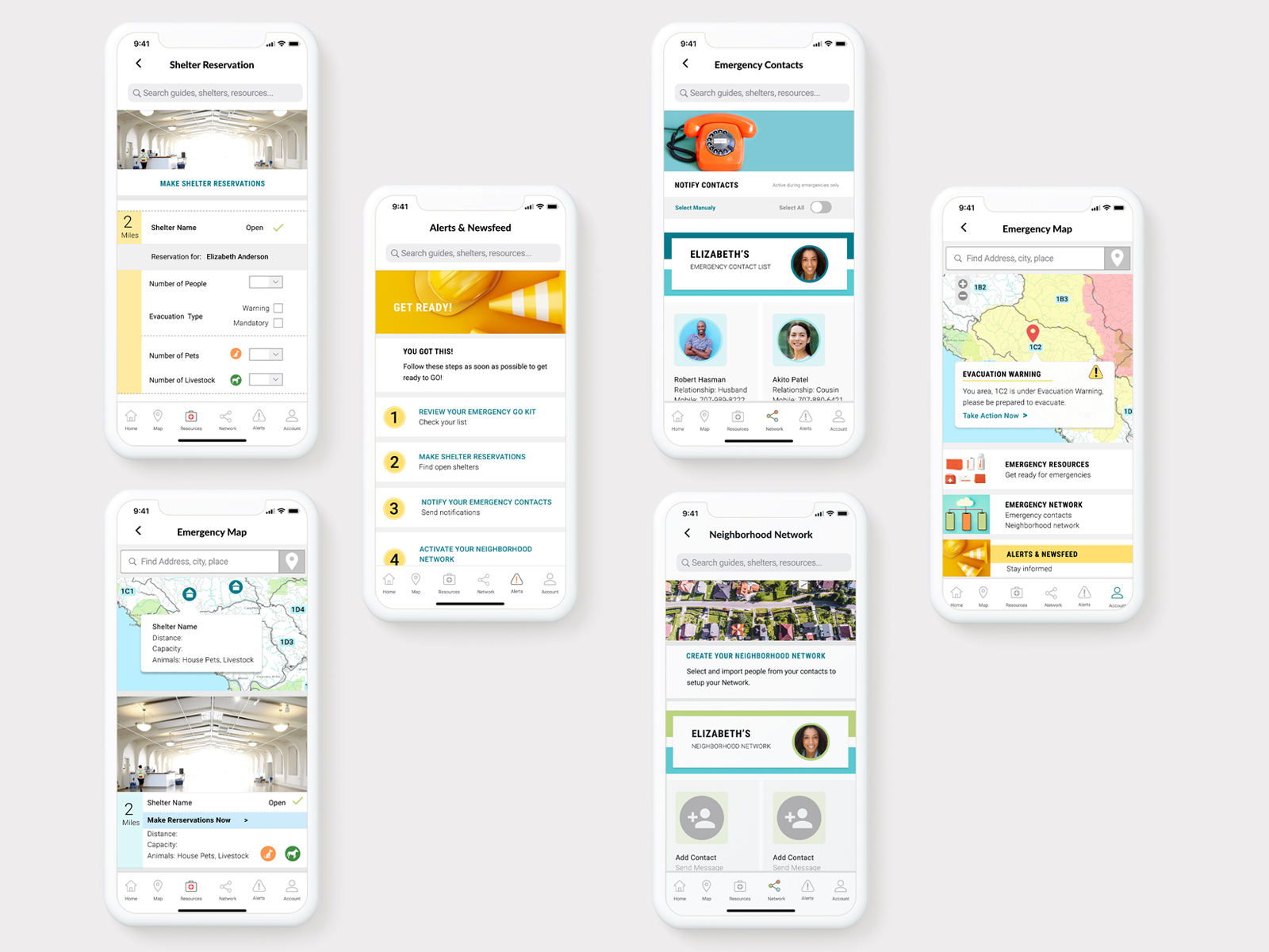
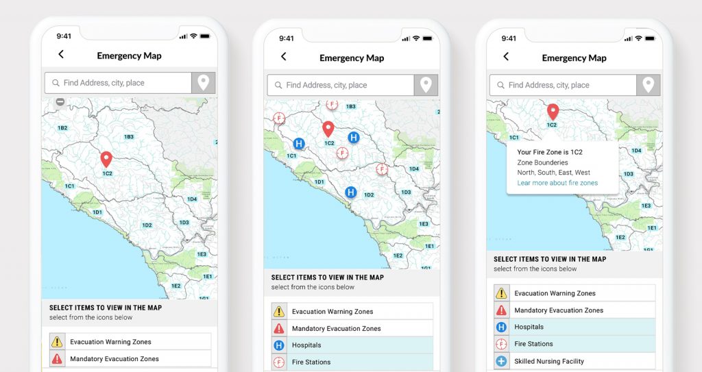
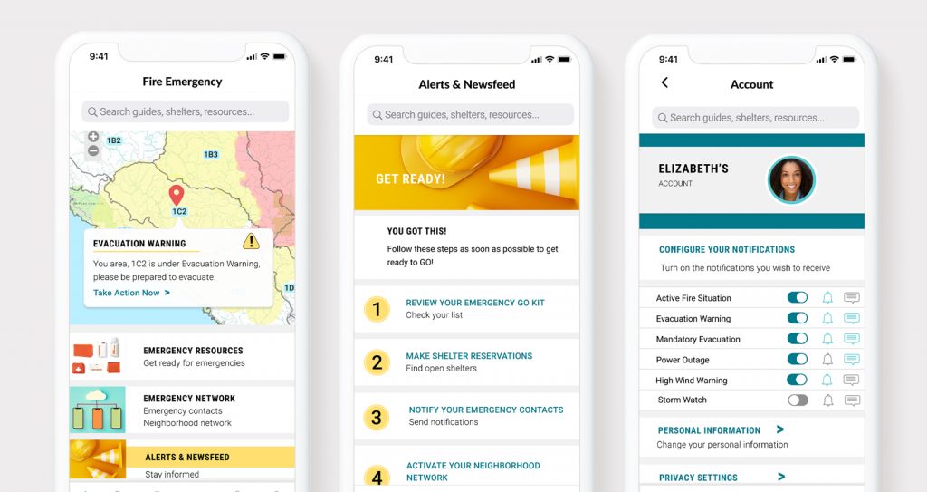
1. THE FIRE INCIDENT MAP
The map is the main tool used to follow the progress of wild fires, evacuation warning zones, mandatory warning zones, road closures; as well as location and driving directions to shelters, hospitals, resource centers, and evacuation routes.
Emergency Map UI
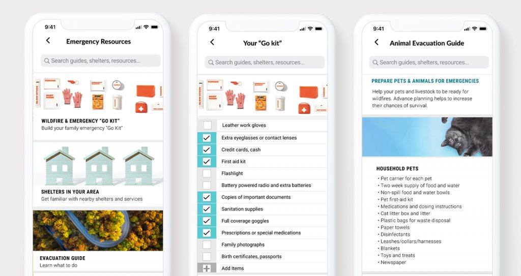
2. EMERGENCY RESOURCES
The emergency resources present the user with preparation guides, a personalized “go kit,” and contact to local government agencies. Additionally, it provides a guide to evacuate animals and pets and gives information on local shelter reservations.
Emergency Resources UI
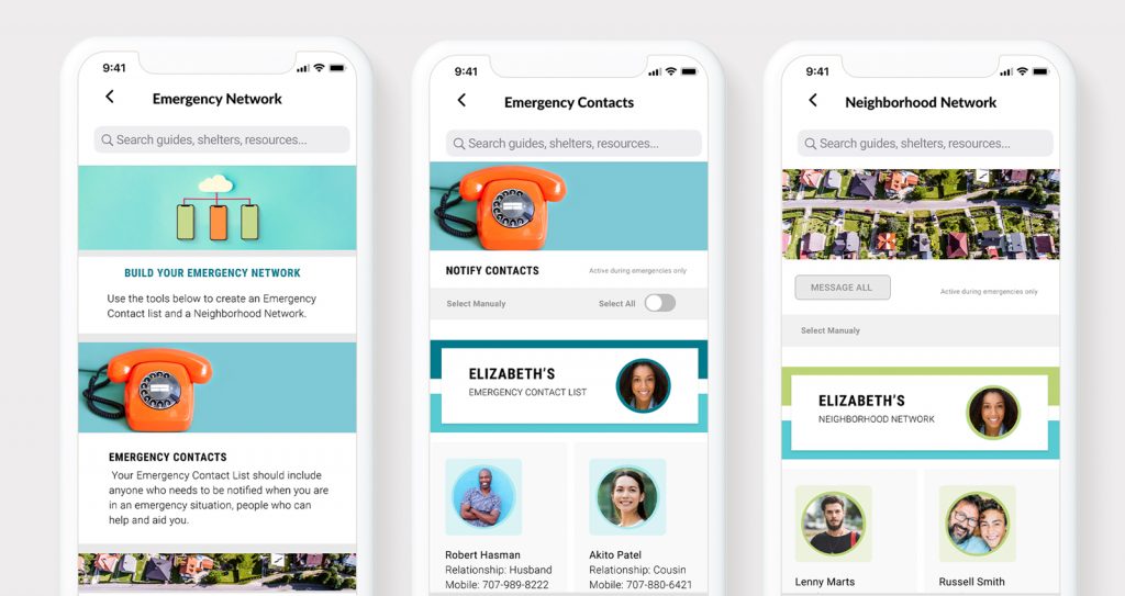
3. EMERGENCY NETWORKS
A. Emergency Contacts
The user can build their personal emergency network to share location and evacuation status by using SMS notifications.
B. Neighborhood Network
The users can build their personal neighborhood network that is activated during active fire situations. This network will allow the users to contact neighbors by text or phone calls.
Emergency Network UI
4. ALERTS & NEWSFEED
Provides a constant flow of information about the progress of wildfires, weather alerts, and evacuation status.